
Source: X / @NWS
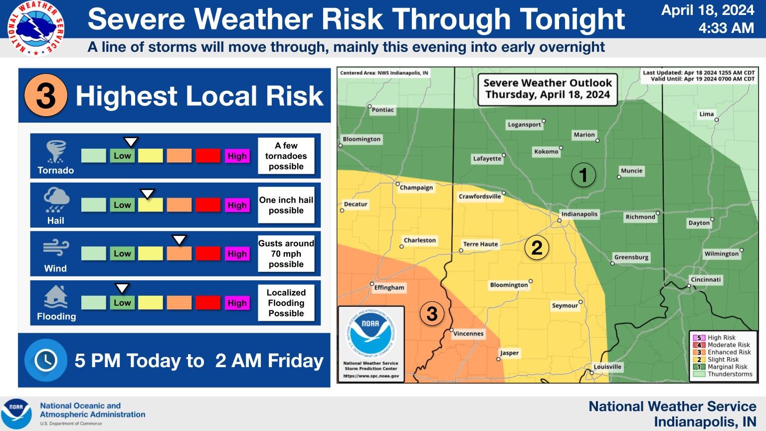
INDIANAPOLIS — Today’s forecast includes severe weather with a range of possibilities. According to the National Weather Service, we might experience strong winds, large hail, and tornadoes. However, the primary concern for Central Indiana is the risk of straight-line damaging winds.
The storms are expected to arrive around five o’clock tonight, entering the state by crossing the border between Illinois and Indiana before moving across Indiana.
“Everything is on the table, but I do think the primary hazard will be straight-line damaging winds,” says Matt Eckhoff of the National Weather Service. “The lesser threat is hail and tornadoes, but it still exists.”
Eckhoff says that because an imminent severe weather threat is expected at night, it’s best to double-check the forecast and increase the volume of your electronic notifications to avoid being caught off guard in case of any developments.
“The threat this evening is going to be Southwest, more towards Bloomington, Terra Haute, and Vincennes,” he says.
Large hail is forecasted mainly for Illinois, but there’s still a chance of encountering it here due to a squall line, a line of organized thunderstorms that may contain embedded tornadoes.
“One way to stay prepared is to have multiple ways to get warnings,” he added. “Check the forecast before you go to bed and ensure you’re aware of any changes.”
The post Indiana Severe Weather, Everything’s on the Table appeared first on WIBC 93.1 FM.
Indiana Severe Weather, Everything’s on the Table was originally published on wibc.com