NWS: Light Snow Through Friday, Minor Accumulation
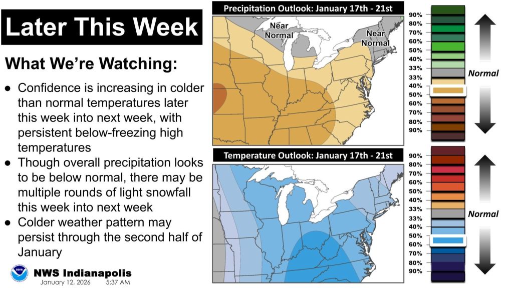
INDIANAPOLIS — Central Indiana could see several rounds of light snow through the end of the week, but forecasters say any accumulation should remain minor.
“We’re not looking for any sort of significant snow or a significant system,” said Jason Puma, a forecaster with the National Weather Service. “Most places are looking at less than a half inch at a time.”
Snow chances begin Wednesday, with about a 60% chance of light snow during the day and into Wednesday night, Puma said. A brief break arrives Thursday, which is expected to be mostly sunny with a high near 25.
“It’s cold, but it’s a break from the snow,” Puma said.
Snow chances return Thursday night and again Friday, when light accumulation is possible.
“Between the two systems, maybe around an inch at most,” Puma said.
The best chance for higher totals will be northeast of Interstate 74, including parts of northern Indiana.
“If you’re northeast of I-74, especially toward Mishawaka and closer to Lake Michigan, you have better odds for a little enhancement,” Puma said.
Some snow showers could affect the Friday morning commute, though impacts are expected to be limited.
“It’s enough to coat the roads and maybe create a few slick spots,” Puma said.
Colder air will follow as Arctic air pushes south from Canada.
“We’re heading into a colder pattern for the next seven to 10 days,” Puma said. “Sunday highs will be near 20, and Martin Luther King Day looks closer to 25.”
NWS: Light Snow Through Friday, Minor Accumulation was originally published on wibc.com


